Portal:Cumbria
The Cumbria Portal The County Flag of Cumbria Cumbria (/ˈkʌmbriə/ KUM-bree-ə) is a ceremonial county in North West England, bordering Scotland. It came into existence in 1974 after the passage of the Local Government Act 1972. In April 2023, its county council was abolished and all of its administrative functions were taken over by Westmorland and Furness and Cumberland. Cumbria's largest settlement is Carlisle and other major settlements include Barrow-in-Furness, Kendal, Whitehaven and Workington. Between 1974 and 2023, Cumbria was a non-metropolitan county divided into six districts; Allerdale, Barrow-in-Furness, Carlisle, Copeland, Eden and South Lakeland. Cumbria is the third largest ceremonial county in England by area. It is bounded to the north-east by Northumberland, the east by County Durham, the south-east by North Yorkshire, the south by Lancashire, the west by the Irish Sea, and the north by the Scottish council areas of Dumfries and Galloway and Scottish Borders. In 2019, Cumbria had a population of 500,012 making it one of the most sparsely populated ceremonial counties in England, with 73.4 people per km2 (190/sq mi). (Full article...) Selected article -
HMS Cardiff was a British Type 42 destroyer and the third ship of the Royal Navy to be named in honour of the Welsh capital city of Cardiff. Cardiff served in the Falklands War, where she was involved in the 1982 British Army Gazelle friendly fire incident. She also shot down the last Argentine aircraft of the conflict and accepted the surrender of a 700-strong garrison in the settlement of Port Howard. (Full article...)General imagesThe following are images from various Cumbria-related articles on Wikipedia.
Recognised content
Brougham Castle • HMS Cardiff (D108) • Norman Birkett, 1st Baron Birkett
File:Derwent Water, Keswick - June 2009.jpg • File:Helvellyn Striding Edge 360 Panorama, Lake District - June 09.jpg • File:Keswick, Cumbria Panorama 1 - June 2009.jpg • File:Keswick Panorama - Oct 2009.jpg • File:Catbells Northern Ascent, Lake District - June 2009.jpg • File:Glenridding, Cumbria, England - June 2009.jpg
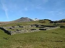
Andrew Johnston (singer) • Askam and Ireleth • Brough Castle • Grayrigg derailment • Herdwick • Lady in the Lake trial • Nethermost Pike • The Story of a Fierce Bad Rabbit • The Story of Miss Moppet • The Tale of Benjamin Bunny • The Tale of Jemima Puddle-Duck • The Tale of Mr. Jeremy Fisher • The Tale of Mr. Tod • The Tale of Mrs. Tiggy-Winkle • The Tale of Mrs. Tittlemouse • The Tale of The Flopsy Bunnies • The Tale of Timmy Tiptoes Selected geographic feature -
The Ease Gill Cave System is the longest, and most complex cave system in Britain as of 2011, with around 41 miles (66 km) of passages, including connections only passable by cave diving. It spans the valley between Leck Fell and Casterton Fell. The water resurges into Leck Beck. The first-discovered entrance, Lancaster Hole, was found by George Cornes and Bill Taylor on 29 September 1946. A small draughting opening on Casterton Fell, Cumbria, opened immediately onto a 110-foot (34 m) shaft. Passages from the base of the shaft were explored over the succeeding weeks and months by members of the British Speleological Association, including Jim Eyre. The underground course of the Ease Gill (the local master cave) and high-level fossil passages above it were found and followed upstream to a series of complex inlet passages. In succeeding years, these have been connected to surface caves, including Top Sinks, County Pot and Pool Sink. (Full article...)SubcategoriesCategory puzzle Select [►] to view subcategories
Cumbria Cumbria-related lists Buildings and structures in Cumbria Burials in Cumbria Crime in Cumbria Culture in Cumbria Deputy Lieutenants of Cumbria Economy of Cumbria Education in Cumbria Environment of Cumbria Films shot in Cumbria Furness Geography of Cumbria Geology of Cumbria Health in Cumbria History of Cumbria Local government in Cumbria Mass media in Cumbria Organisations based in Cumbria People from Cumbria Politics of Cumbria Religion in Cumbria Science and technology in Cumbria Sport in Cumbria Tourist attractions in Cumbria Transport in Cumbria WikiProjectsWikiProjects related to Cumbria:
WikiProjects about things important to Cumbria:
TopicsSelected picture A panoramic view of the town of Keswick, nestled between the fells of Skiddaw and Derwent Water in the Lake District. Taken from about three quarters of the way to the summit of Walla Crag. A panoramic view of the town of Keswick, nestled between the fells of Skiddaw and Derwent Water in the Lake District. Taken from about three quarters of the way to the summit of Walla Crag.
Related portalsTasks
Associated WikimediaThe following Wikimedia Foundation sister projects provide more on this subject:
Discover Wikipedia using portals
| ||||||
_1.jpg.webp)


.jpg.webp)


.jpg.webp)