Portal:Nebraska
The Nebraska Portal Migrating sandhill cranes (Antigone canadensis) depart their overnight roosting area in the Platte River near Kearney, Nebraska, at dawn (2015).
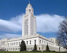
 The Flag of Nebraska Nebraska (/nəˈbræskə/ ( Indigenous peoples, including Omaha, Missouria, Ponca, Pawnee, Otoe, and various branches of the Lakota (Sioux) tribes, lived in the region for thousands of years before European exploration. The state is crossed by many historic trails, including that of the Lewis and Clark Expedition. Nebraska's area is just over 77,220 square miles (200,000 km2) with a population of over 1.9 million. Its capital is Lincoln, and its largest city is Omaha, which is on the Missouri River. Nebraska was admitted into the United States in 1867, two years after the end of the American Civil War. The Nebraska Legislature is unlike any other American legislature in that it is unicameral, and its members are elected without any official reference to political party affiliation. (Full article...) Selected article -The history of Lincoln, Nebraska began with the settlement of the village of Lancaster in 1856. The county of Lancaster was founded in 1859. Prior to settlement from the westward expansion of the United States, Plains Indians, descendants of indigenous peoples who occupied the area for thousands of years lived in and hunted along Salt Creek. Settlers first came to extract salt from the wild salt flats of Salt Creek. Nebraska was granted statehood March 1, 1867. Soon afterwards a commission created by the State was appointed to locate the State Capital on State lands. The village of Lancaster was chosen for the Capital of Nebraska. The village of Lancaster became Lincoln. Lincoln was named after Abraham Lincoln. The first State Capitol was completed in 1868. Lincoln incorporated on April 1, 1869. By 1870, railroads began to use Lincoln as a stop westward, and by 1892, Lincoln was a rail center. In the early twentieth century, Volga-German immigrants from Russia began settling in the North Bottoms neighborhood. By 1911, the Omaha-Lincoln-Denver Highway (O-L-D) established through Lincoln. By 1920 the first air field Union Airport was established northeast of Lincoln. As transportation linked Lincoln to points east, west, north and south, the cities population grew to 54,948 by 1920. (Full article...)Selected biography -
Solomon D. Butcher (January 24, 1856 – March 18, 1927) was an itinerant photographer who spent most of his life in central Nebraska, in the Great Plains region of the United States. A settler under the Homestead Act, he began in 1886 to produce a photographic record of the history of white settlement in the region. Over 3,000 of his negatives survive; more than 1,000 of these depict sod houses. Butcher wrote two books incorporating his photographs: Pioneer History of Custer County and Short Sketches of Early Days in Nebraska (1901), and Sod Houses, or the Development of the Great American Plains (1904). Butcher was unable to achieve financial success as a farmer, as a photographer, or in a number of other schemes later in his life, and at the time of his death felt that he had been a failure. However, the number and scope of his photographs of Nebraska pioneer life have made them a valuable resource to students of that period of history, and they have become a staple of historical texts and popular works alike. His oeuvre has been described as "the most important chronicle of the saga of homesteading in America". (Full article...)Counties (clickable map)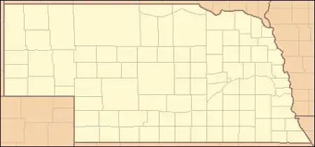
General images -The following are images from various Nebraska-related articles on Wikipedia.
Did you know -
Related portalsTopicsLargest cities
CategoriesCategory puzzle Select [►] to view subcategories
Nebraska Nebraska-related lists Buildings and structures in Nebraska Communications in Nebraska Nebraska culture Economy of Nebraska Education in Nebraska Environment of Nebraska Geography of Nebraska Government of Nebraska Health in Nebraska History of Nebraska Nebraska law Military in Nebraska Native American tribes in Nebraska People from Nebraska Politics of Nebraska Professional wrestling in Nebraska Science and technology in Nebraska Nebraska society Sports in Nebraska Tourist attractions in Nebraska Transportation in Nebraska Works about Nebraska Images of Nebraska Nebraska stubs New articlesThis list was generated from these rules. Questions and feedback are always welcome! The search is being run daily with the most recent ~14 days of results. Note: Some articles may not be relevant to this project.
Rules | Match log | Results page (for watching) | Last updated: 2023-04-05 21:37 (UTC) Note: The list display can now be customized by each user. See List display personalization for details.
WikiProjects
Associated WikimediaThe following Wikimedia Foundation sister projects provide more on this subject:
Sources
| ||||||||||||||||||||||||||||||||||||||||||||||||||||||||||||||||||||||||||||||||||||||||||||||||||||||


.jpg.webp)