Kumbalam, Ernakulam
Kumbalam is a picturesque region in Kochi, in the state of Kerala, India. A water-bound countryside, bound by the Vembanad Lake, as well as the fast-encroaching city of Kochi, it is situated around 9 km from Vytilla Junction.[1]
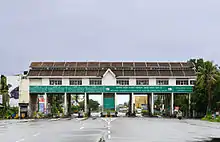
Kumbalam toll plaza
Kumbalam
കുമ്പളം | |
|---|---|
Locality | |
 NH 47 view from Kumbalam | |
 Kumbalam Location in Kerala, India  Kumbalam Kumbalam (India) | |
| Coordinates: 9.90°N 76.31°E | |
| State | Kerala |
| District | Ernakulam |
| Government | |
| • Body | Kumbalam Grama Panchayath |
| Elevation | 3 m (10 ft) |
| Population | |
| • Total | 24,143 |
| • Density | 1,161/km2 (3,010/sq mi) |
| Languages | |
| • Official | Malayalam, English |
| Time zone | UTC+5:30 (IST) |
| PIN | 682506 |
| Lok Sabha constituency | Ernakulam |
| Civic agency | Kumbalam Grama Panchayath |
| Climate | Tropical monsoon (Köppen) |
| Avg. summer temperature | 35 °C (95 °F) |
| Avg. winter temperature | 20 °C (68 °F) |
Location
Kumbalam is surrounded by Thevara in North, Wellington Island in North West, Edakochi in West, Kumbalangi in South West, Aroor in South, Panangad in Eastern side, Nettoor in North Eastern side.
References
- "Pay more at Kumbalam toll plaza from today". The Times of India. 1 April 2018. Retrieved 21 January 2023.
Places around Kumbalam | |
|---|---|
Wikimedia Commons has media related to Kumbalam, Ernakulam.
This article is issued from Wikipedia. The text is licensed under Creative Commons - Attribution - Sharealike. Additional terms may apply for the media files.